


Putting spatial data
to work
Rooted in engineering, transportation, infrastructure, and spatial data management, Geonetics’ primary business is enabling our clients to better manage and make decisions using mobile, web, and geographic information system (GIS) technologies.
Our team is well known for automating business workflows and data management functions with innovation and a wide variety of creative reporting and visualization technologies, making organizations more efficient and more connected than ever before.
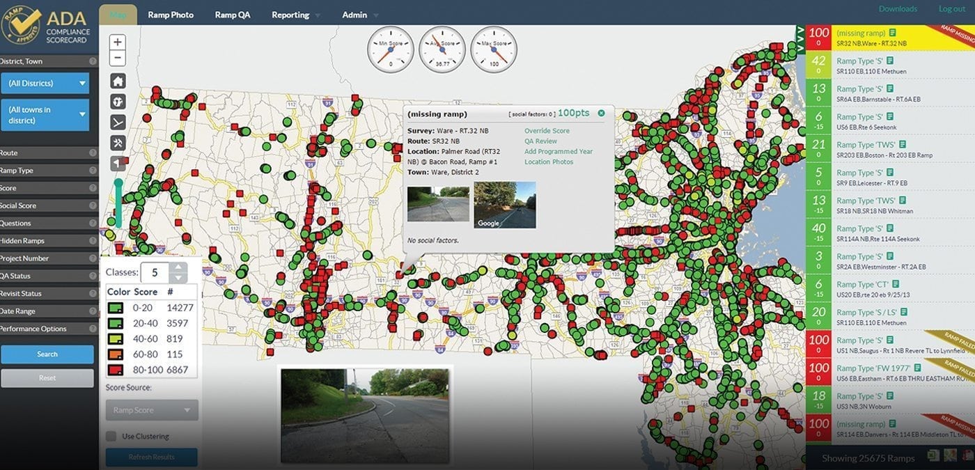
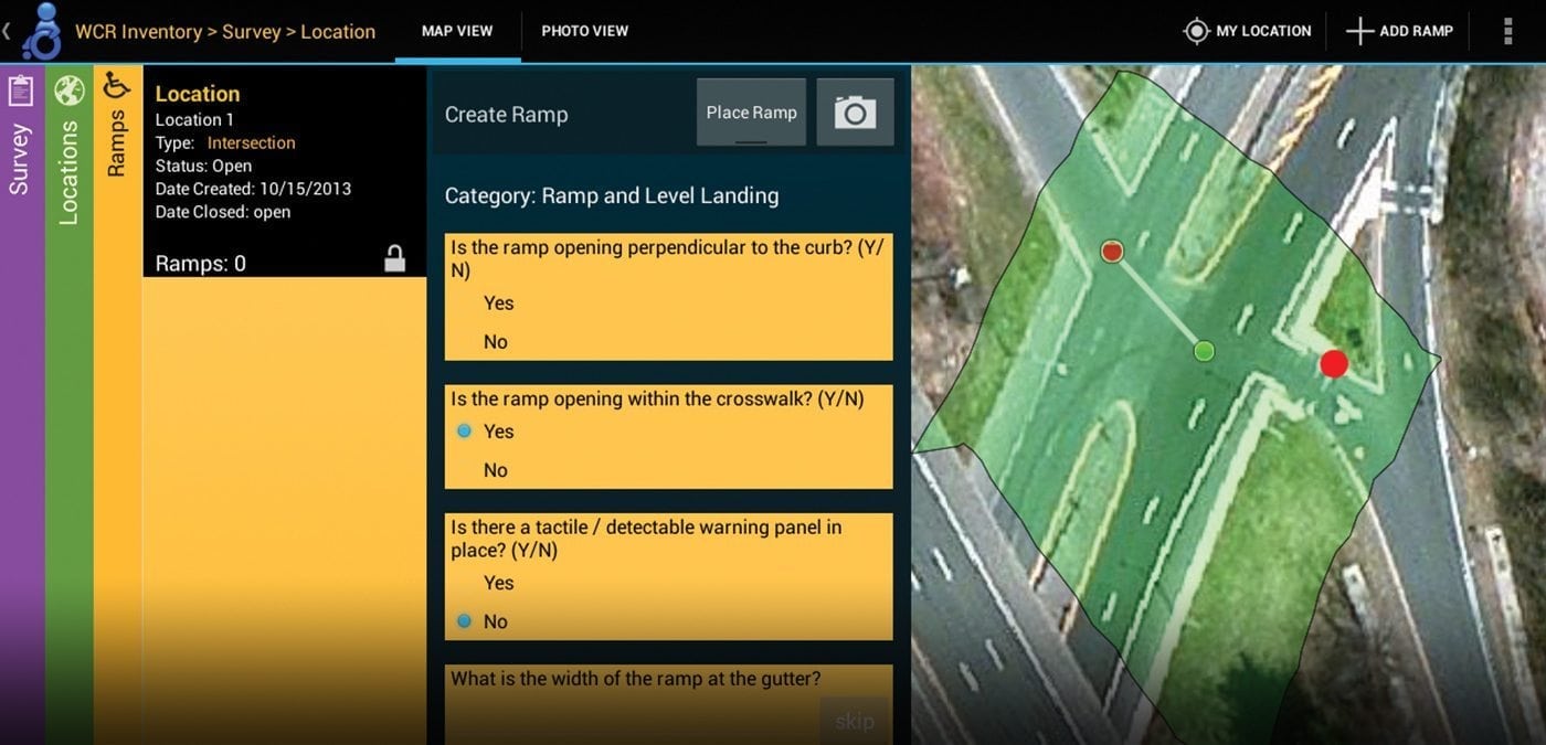
Geonetics has developed hundreds of custom mobile and distributed software applications for transportation and government, managing all facets of real estate from parcel ownership through permitting, coastal, dam, and flood management, accessible infrastructure, wetlands, street linear referencing systems and more. Founded in 1995 as a subsidiary of BSC Group, Geonetics provides the following services:
- Database Design and Development
- Mobile, Web, and Desktop Software Development
- Geographic Information Systems and 3D Automation
- Business Process Management Services
- Reporting and Data Analytics

Matthew von Wahlde, Custom Software Services Leader
Matt’s diverse professional background combines environmental science and information technology with GIS design and implementation. He has extensive experience in all phases of IT project lifecycle management. Matt has in-depth knowledge of user interface requirements between GIS and relational database systems. He specializes in transportation industry enterprise management systems and supporting data models. Matt has applied this expertise to a variety of project types, including support for natural resource management, statewide accessibility improvements, and dam safety monitoring.
Contact Matthew at mvwahlde@geonetics.com.